(Editor's Note: This article was published first at Illinois Policy Institute).
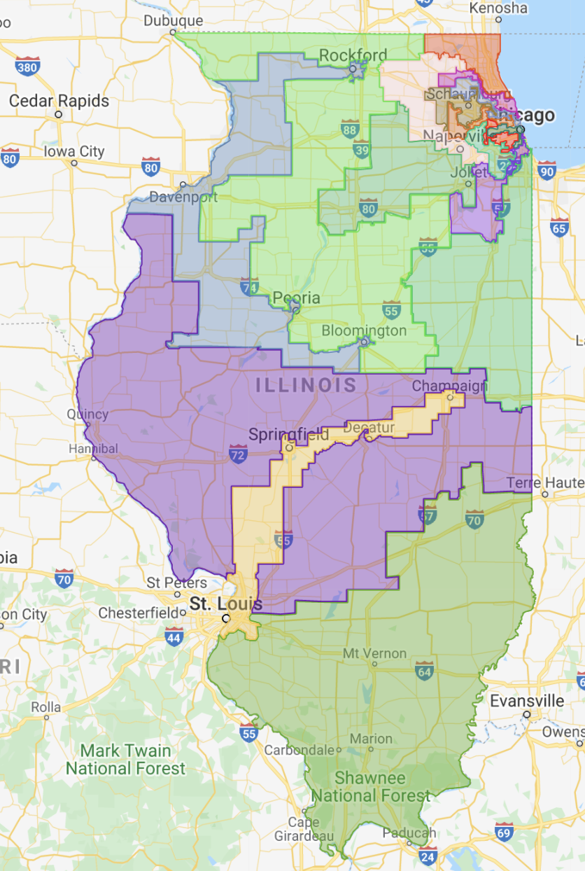
Illinois Democratic lawmakers passed the fourth version of their proposed congressional district maps after they had revealed a third proposed congressional map Oct. 26, just three days after releasing a second draft.
Map No. 2 created a second Hispanic district in response to concerns Illinois’ sizeable Hispanic community warranted representation in more than one congressional district. The third map further consolidated Democratic power.
The first map proposal released Oct. 15 was graded as a fail by the Princeton Gerrymandering Project’s Redistricting Report Card. It lacked partisan fairness, lacked compactness, created excessive splitting of county lines and offered middling competitiveness.
 Democrats may have revised the original map because it didn’t give them enough of an edge. Even though the original map was biased in favor of Democrats, it would have created potential swing districts that would have put them in play for Republicans in 2022.
The final map tightens Democrats’ grip on the state’s congressional seats with a solid 14-3 advantage, taking away two seats from the current five held by the GOP delegation. Illinois sends 13 Democrats and five Republicans to Congress at present, but has lost one U.S. representative because of population loss, dropping from 18 to 17.
In taking away GOP seats, the second map put Republican U.S. Reps. Adam Kinzinger and Darin LaHood and U.S. Reps. Mary Miller and Mike Bost in the same districts, pitting them against each other in Republican primaries. While generally giving disproportionate partisan advantages to Illinois Democrats, version No. 2 also put Democratic Reps. Sean Casten and Marie Newman in the same district.
But the third map may be even more gerrymandered. The Princeton Gerrymandering Project gave the most recent map an even worse grade than the first map. Where the first map was given a “C” on competitiveness, the newest map grades an “F,” giving the state F’s across all three metrics of partisan fairness, competitiveness and geography. The final map looks much the same, and received similarly failing marks.

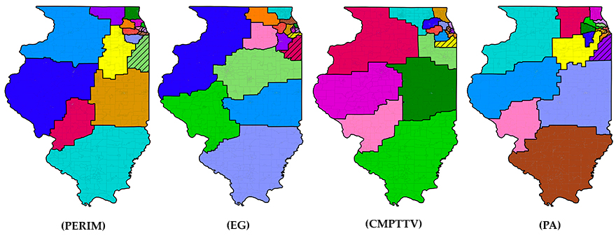
A report from the University of Illinois’ Institute for Computational Redistricting illustrates how gerrymandered these partisan maps really are by providing a clear computer-generated contrast. In prioritizing goals such as compactness and balancing the number of “wasted votes” either party receives, maps drawn by algorithms can be compared to the current proposals. None of those proposals give Democrats such a clear and overwhelming majority as the current plans.
The partisan nature of the congressional redistricting process could be mitigated through a well-crafted independent redistricting commission. Though U.S. representatives in Illinois do not draw their own districts like their state lawmaker counterparts, the partisan nature of the process is clear.
An independent redistricting commission that requires input from both sides of the aisle alongside representation for those who do not align with either side would be an improvement over the status quo. Ten states already give independent commissions authority to draw congressional maps, according to the National Conference of State Legislatures.
Such a commission could be established through state law without a constitutional amendment in Illinois. The state passes congressional maps by statute, and congressional redistricting is not currently restricted by the state’s constitution.
Until such a reform is implemented, partisan gerrymandering in congressional maps will be the norm despite pledges to the contrary. Illinois can do better.
